

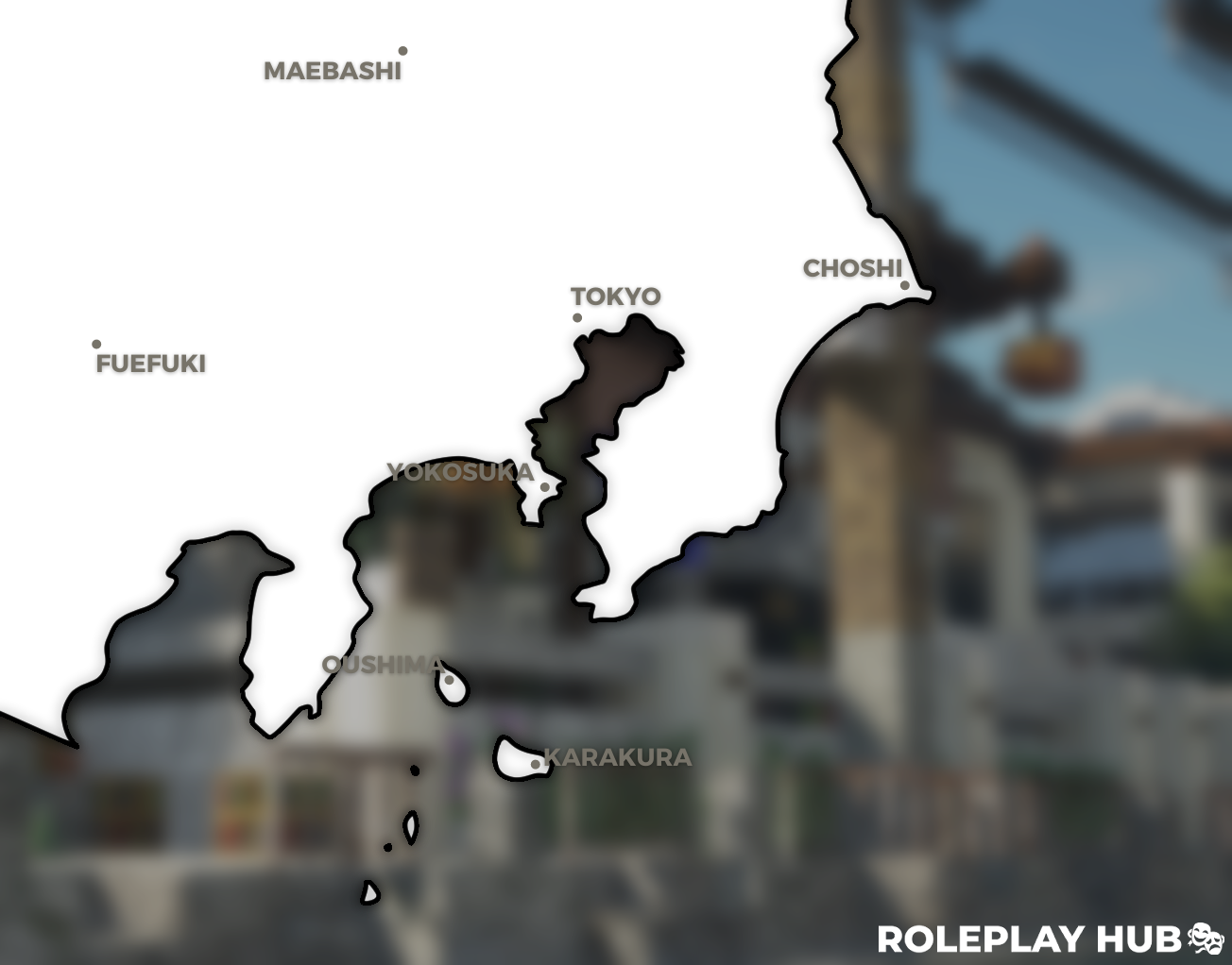
Karakura (空座町, Karakura-cho, Izu-karakura) is an islandic city located southeast of Tokyo (東京), a fictional place noted as the largest island in the Izu archipelago. Considered a special administrative area of Japan within the Tokyo Prefecture that includes its own government and constitution, its square length of 102.25km, and a mountainous range of Kohaku creating physical borders around its mass of land are what characterize the place as generally suburban and rural. The islands of the Izu archipelago include Oushima, Toshima, Niijima, and Kozushima. Karakura itself is also located closest to mainland cities such as Tateyama (館山市) in the Chiba Prefecture and Yokosuka (横須賀市) in the Kanagawa Prefecture. The second-largest island in Izu, Oushima, is famed for its active volcano which happens to affect temperatures within Karakura and other patterns in wildlife when it acts.
.png (1).jpg")

The above is a sketch of Karakura Island in the 1800s during the Edo period.
The city of Karakura is divided into 12 districts that were formed in 1998 by the Government of Karakura. The districts are as followed: Karakura Palaza, Karakura Highschool and College, Business Park, North-Western Karakura, Teams' District, Karakura Shopping District, Motokawa, Kaigan, Shizukanamichi, Karakura Pier, Itsbyoshi, and Ochiba. More can be learned in the Districts and Roads of Kakura thread.
Karakura itself is an oblong-shaped island that is divided into 4 major parts by the Kohaku Mountain Range: Karakura City, Kampo Forest, Itsbyoshi Forest, and Ochiba Forest. The city is surrounded by a U-shape formation of the Kohaku Mountains with a small valley within that connects the larger Outer Ochiba Forest to the smaller Inner Ochiba Forest. The other two forests that extend into the city are the Itsbyoshi Forest and the Shizukanamichi Woods. Other smaller areas on the island are the Motokawa Forest, the Ichikawa Woods, Yagi Groves, Ogonshoku Woods, and smaller hours scattered across the island.
Today, past the Togu Tunnel is the rural district of Tsubasa which contains a library, a delivery center, a grocery store, a small clinic, and other miscellaneous facilities for its population. Yet, the largest facilities outside of Karakura Main City is Karakura Elementary School for the younger population and Karakura International Airport. The most troubling hardship within the existence of Karakura is its rampant crime rate, which was never threatened to lower even after Japan forced the island’s government to isolate itself from the mainland.
Last edited: